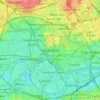
Топографическая карта Merseyside
Нажмите на карту, чтобы отобразить высоту.
Об этой карте

Название: Топографическая карта Merseyside, высота, рельеф.
Местонахождение: Merseyside, Liverpool City Region, England, United Kingdom (53.28636 -3.26376 53.70436 -2.57674)
Средняя высота: 23 м
Минимальная высота: -1 м
Максимальная высота: 243 м
Другие топографические карты
Нажмите на карту, чтобы просмотреть ее топографию, ее высоту и ее рельеф.
Cambridge
United Kingdom > England > Cambridge
The city, like most of the UK, has a maritime climate highly influenced by the Gulf Stream. Located in the driest region of Britain, Cambridge's rainfall averages around 570 mm (22.44 in) per year, around half the national average, with some years occasionally falling into the semi-arid (under 500 mm (19.69…
Средняя высота: 18 м

Leeds
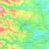
Lying in the eastern foothills of the Pennines, there is a significant variation in elevation within the city's built-up area. The district ranges from 1,115 feet (340 m) in the far west on the slopes of Ilkley Moor to about 33 feet (10 m) where the rivers Aire and Wharfe cross the eastern boundary. Land rises…
Средняя высота: 94 м

Crowborough
United Kingdom > England > Wealden > Crowborough
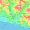
In the late 19th century Crowborough was promoted as a health resort based on its high elevation, the rolling hills and surrounding forest. Estate Agents even called it "Scotland in Sussex". The town's golf course opened in 1895, followed by a fire station and hospital in 1900.
Средняя высота: 125 м
Burton upon Trent
United Kingdom > England > Staffordshire > East Staffordshire
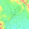
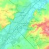
Burton is about 109 miles (175 km) north west of London, about 30 miles north east of Birmingham, the UK's second largest city and about 23 miles east of the county town Stafford. It is at the easternmost border of the county of Staffordshire with Derbyshire, its suburbs and the course of the River Trent…
Средняя высота: 69 м


Clapham
In 1848, Clapham was described in the Topographical Dictionary of England as a village which "has for many years, been one of the most respectable in the environs of the metropolis". At this time, the patronage of Holy Trinity church belonged to the Atkins family.
Средняя высота: 22 м


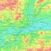
City of London
United Kingdom > England > City of London > City of London
The elevation of the City ranges from sea level at the Thames to 21.6 metres (71 ft) at the junction of High Holborn and Chancery Lane. Two small but notable hills are within the historic core, Ludgate Hill to the west and Cornhill to the east. Between them ran the Walbrook, one of the many "lost" rivers or…
Средняя высота: 42 м

Salford
At 53°28′59″N 2°17′35″W / 53.48306°N 2.29306°W / 53.48306; -2.29306 (53.483°, −2.2931°), and 205 miles (330 km) northwest of central London, Salford stands about 177 feet (54 m) above sea level, on relatively flat ground to the west of a meander of the River Irwell – the city's main…
Средняя высота: 106 м
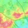
Elstree
United Kingdom > England > Hertfordshire > Hertsmere
In 1723, topographer John Norden noted in his book Speculum Britanniae, that in the county of Hartfordshire [sic] was one "Elstre or Eglestre". In an earlier edition, he writes.
Средняя высота: 105 м
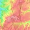

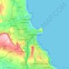
Scarborough
United Kingdom > England > North Yorkshire
The climate is temperate with mild summers and cool, windy, winters. The hottest months of the year are July and August, with temperatures reaching an average high of 17 °C and falling to 11 °C at night. The average daytime temperatures in January are 4 °C, falling to 1 °C at night. The station's elevation…
Средняя высота: 39 м


Kings Heath
United Kingdom > England > West Midlands Combined Authority > Birmingham > Kings Heath
Средняя высота: 142 м

Newbury
United Kingdom > England > Newbury
Elevations vary from a minimum of 72m above mean sea level to 122m at Wash Common. Elevations reach 150-200m in the directly adjoining hills.
Средняя высота: 102 м

Morpeth
United Kingdom > England > Morpeth
Cockle Park, located slightly north of Morpeth, contains a Met Office weather station, founded in 1897. The following table shows the climate data of the station from 1971–2000, recorded at 95 metres (312 ft) elevation.
Средняя высота: 70 м
Salisbury
United Kingdom > England > Salisbury
Bishop of Salisbury Hubert Walter was instrumental in the negotiations with Saladin during the Third Crusade, but he spent little time in his diocese prior to his elevation to archbishop of Canterbury. The brothers Herbert and Richard Poore succeeded him and began planning the relocation of the cathedral into…
Средняя высота: 96 м



St Albans
United Kingdom > England > Hertfordshire > St Albans
St Albans was an ancient borough created following the dissolution of the monastery in 1539. It consisted of the ancient parish of St Albans (also known as the Abbey parish) and parts of St Michael and St Peter. The municipal corporation was reformed by the Municipal Corporations Act 1835 and the boundary was…
Средняя высота: 100 м
Swindon
United Kingdom > England > Swindon
Swindon has an oceanic climate (Cfb in the Köppen climate classification), like the vast majority of the British Isles, with cool winters and warm summers. The nearest official weather station is RAF Lyneham, about 10 miles (16 km) west southwest of Swindon town centre. The weather station's elevation is 145…
Средняя высота: 108 м


Gateshead
United Kingdom > England > Tyne and Wear > Gateshead
One of the most distinguishing features of Gateshead is its topography. The land rises 230 feet (70 m) from Gateshead Quays to the town centre and continues rising to a height of 525 feet (160 m) at Queen Elizabeth Hospital in Sheriff Hill. This is in contrast to the flat and low lying Team Valley located on…
Средняя высота: 62 м





Basingstoke
United Kingdom > England > Hampshire > Basingstoke and Deane
Situated in a valley through the Hampshire Downs at an average elevation of 88 metres (289 ft) Basingstoke is a major interchange between Reading, Newbury, Andover, Winchester, and Alton, and lies on the natural trade route between the southwest of England and London. The area had been something of an…
Средняя высота: 109 м


Plymouth
United Kingdom > England > Devon > Plymouth
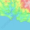
The River Plym, which flows off Dartmoor to the north-east, forms a smaller estuary to the east of the city called Cattewater. Plymouth Sound is protected from the sea by the Plymouth Breakwater, in use since 1814. In the Sound is Drake's Island which is seen from Plymouth Hoe, a flat public area on top of…
Средняя высота: 81 м


Devitts Green
United Kingdom > England > Warwickshire > North Warwickshire > Old Arley
Средняя высота: 131 м



Horsenden Hill
United Kingdom > England > London
The base of this isolated hill is at an altitude of approximately 50 metres. Like all of the immediately surrounding area, the base of the hill, as well as the slopes of the hill up to about 70m, are on London Clay. Between about 70m and 80m is an isolated layer of sandier Claygate Beds. Both deposits are of…
Средняя высота: 40 м

Tottenham
United Kingdom > England > Greater London
Tottenham's elevation is approximately 33 ft (10 m) above sea level.
Средняя высота: 25 м




Rudyard Lake
United Kingdom > England > Staffordshire > Staffordshire Moorlands > Rudyard > Horton
Средняя высота: 205 м






Bradford
Bradford is located at 53°45′00″N 01°50′00″W / 53.75000°N 1.83333°W / 53.75000; -1.83333 (53.7500, -1.8333)1. Topographically, it is located in the eastern moorland region of the South Pennines.
Средняя высота: 167 м




Putney
Putney Heath is around 400 acres (160 hectares) less the nascent A3 road in size and rises to 45 metres (148 ft) above sea level. Because of its elevation, from 1796 to 1816 Putney Heath hosted a station in the shutter telegraph chain, which connected the Admiralty in London to its naval ships in Portsmouth.…
Средняя высота: 18 м