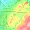
Топографическая карта Preston
Нажмите на карту, чтобы отобразить высоту.
Об этой карте

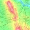
Название: Топографическая карта Preston, высота, рельеф.
Местонахождение: Preston, Lancashire, England, PR1 2AR, United Kingdom (53.59934 -2.85927 53.91934 -2.53927)
Средняя высота: 80 м
Минимальная высота: 0 м
Максимальная высота: 519 м
Другие топографические карты
Нажмите на карту, чтобы просмотреть ее топографию, ее высоту и ее рельеф.

Whitworth
United Kingdom > England > Lancashire > Borough of Rossendale > Healey
Средняя высота: 317 м
Burnley
United Kingdom > England > Lancashire
The town lies in a natural three-forked valley at the confluence of the River Brun and the River Calder, surrounded by open fields, with wild moorland at higher altitudes. To the west of Burnley lie the towns of Padiham, Accrington and Blackburn, with Nelson and Colne to the north. The centre of the town…
Средняя высота: 247 м


Eaves Wood
United Kingdom > England > Lancashire > Lancaster > Silverdale > Silverdale Green
Средняя высота: 30 м

Billington and Langho
United Kingdom > England > Lancashire > Ribble Valley > Brockhall Village
Средняя высота: 58 м

Colne Water
United Kingdom > England > Lancashire > Borough of Pendle > Laneshaw Bridge
Средняя высота: 202 м

River Ribble
United Kingdom > England > Lancashire
On the River Ribble, the tidal bore acts as a hydrodynamic "front," marking the abrupt transition from the prolonged low-water stand to a compressed flood tide. While the Irish Sea rises for over six hours, the narrowing 19th-century training walls funnel the tide into a singular surge, compressing the flood…
Средняя высота: 204 м



River Irwell
United Kingdom > England > Lancashire
The River Irwell catchment area extends from the moors above Bacup to the Manchester Ship Canal. The climate of the catchment area is wetter than the UK average, with rainfall of 1,456 millimetres (57.3 in) per annum compared to 1,231 millimetres (48.5 in) per annum, and the rivers quickly respond to rainfall.…
Средняя высота: 178 м




Barnoldswick
United Kingdom > England > Lancashire > Borough of Pendle > Salterforth
Средняя высота: 175 м
Colne
United Kingdom > England > Lancashire > Borough of Pendle
Pendle Leisure Trust runs the Pendle Leisure Centre next to the railway station. The facility has two swimming pools, a fitness centre and gymnasium, sauna and sports hall. In summer 2013, the outdoor all-weather pitch was replaced by Urban Altitude. This outdoor aerial assault course is the first of its kind…
Средняя высота: 197 м
Bickerstaffe
United Kingdom > England > Lancashire > West Lancashire > Bickerstaffe
Средняя высота: 51 м
Bolton-le-Sands
United Kingdom > England > Lancashire > Lancaster > Bolton le Sands
Средняя высота: 23 м





Bury Hey Wood
United Kingdom > England > Lancashire > West Lancashire > Appley Bridge > Robin Hood
Средняя высота: 106 м
Scarisbrick
United Kingdom > England > Lancashire > West Lancashire > Scarisbrick
Средняя высота: 12 м

Coppull
United Kingdom > England > Lancashire > Chorley
The settlement has an Anglo Saxon name describing its topography derived from the Old English copp a hill top and hyll a hill. The township was variously recorded as Cophull and Cophulle in 1277, Copphull in 1351, Copthull in 1374 and Coppull from 1444.
Средняя высота: 82 м
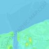
Preesall
United Kingdom > England > Lancashire > Borough of Wyre > Knott End-On-Sea
Средняя высота: 3 м