
Топографическая карта Sandiacre
Нажмите на карту, чтобы отобразить высоту.
Об этой карте
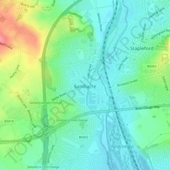
Название: Топографическая карта Sandiacre, высота, рельеф.
Местонахождение: Sandiacre, Erewash, Derbyshire, East Midlands, England, United Kingdom (52.91007 -1.32322 52.93681 -1.27784)
Средняя высота: 57 м
Минимальная высота: 32 м
Максимальная высота: 118 м
Другие топографические карты
Нажмите на карту, чтобы просмотреть ее топографию, ее высоту и ее рельеф.
Stanley
United Kingdom > England > Derbyshire > Erewash
The Church gates commemorate Queen Victoria's Golden Jubilee of 1887, and the churchyard contains a memorial (erected in 2004) to the five aircrew who lost their lives when an experimental high-altitude RAF Wellington Bomber disintegrated above Stanley in 1942 following a loss of cabin pressure.
Средняя высота: 100 м