

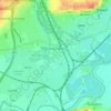
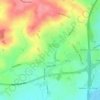
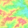
Топографическая карта Stanley
Нажмите на карту, чтобы отобразить высоту.
Stanley
The Church gates commemorate Queen Victoria's Golden Jubilee of 1887, and the churchyard contains a memorial (erected in 2004) to the five aircrew who lost their lives when an experimental high-altitude RAF Wellington Bomber disintegrated above Stanley in 1942 following a loss of cabin pressure.
Об этой карте

Название: Топографическая карта Stanley, высота, рельеф.
Местонахождение: Stanley, Erewash, Derbyshire, East Midlands, England, DE7 6FB, United Kingdom (52.93917 -1.39875 52.97917 -1.35875)
Средняя высота: 100 м
Минимальная высота: 59 м
Максимальная высота: 142 м
Другие топографические карты
Нажмите на карту, чтобы просмотреть ее топографию, ее высоту и ее рельеф.




River Erewash
United Kingdom > England > Derbyshire > Erewash
The approximate meaning of the name is not in doubt, but there is room for debate about the precise derivation and its connotations. Brewer gives the commonly accepted explanation that it comes from the Old English words irre ("wandering") and wisce ("wet meadow"). This is accepted by Kenneth Cameron, a…
Средняя высота: 87 м