
Топографическая карта Jingzhou
Интерактивная карта
Нажмите на карту, чтобы отобразить высоту.
Об этой карте
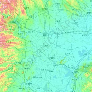
Название: Топографическая карта Jingzhou, высота, рельеф.
Местонахождение: Jingzhou, Hubei, 434000, China (29.41822 111.23863 30.66080 114.08449)
Средняя высота: 156 м
Минимальная высота: 17 м
Максимальная высота: 1 901 м
Jingzhou occupies an area of 14,067 square kilometres (5,431 sq mi) with a topography rising from east to west. It is covered by a dense network of waterways, as well as lakes, and is located in the middle reaches of the Yangtze River on the Jianghan Plain. Downstream to its east lies Wuhan, the provincial capital, and to the west lies the city of Yichang, the Three Gorges, and Chongqing Municipality. Jingmen City, also in Hubei, lies to the north; to its south are Yueyang and Changde, both in Hunan Province. 12.42% of the city's area is forested.