
Сделать пожертвование
Топографическая карта Dylewska Góra
Нажмите на карту, чтобы отобразить высоту.
Сделать пожертвование
Dylewska Góra
Dylewska Góra (German: Kernsdorfer Höhe) is a hill located in northeastern Poland, south of the town of Ostróda, in the Warmian-Masurian Voivodeship. With elevation of 312 metres above sea level, it is one of the highest points of northern and central Poland. Dylewska Góra is a morainic hill, with its eastern and northern slopes covered by beech forest. On top there is a TV tower, as well as a 37-metre-high observation tower, which provides views of area up to 50 kilometres away.
Сделать пожертвование
Об этой карте
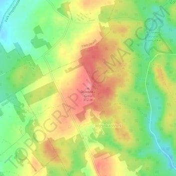
Название: Топографическая карта Dylewska Góra, высота, рельеф.
Местонахождение: Dylewska Góra, Wysoka Wieś, gmina Ostróda, Ostróda County, Warmian-Masurian Voivodeship, Poland (53.55044 19.93985 53.55054 19.93995)
Средняя высота: 269 м
Минимальная высота: 227 м
Максимальная высота: 311 м
Сделать пожертвование