
Сделать пожертвование
Топографическая карта Zitácuaro
Нажмите на карту, чтобы отобразить высоту.
Сделать пожертвование
Zitácuaro
Zitácuaro stands at 19°26′N 100°22′W / 19.433°N 100.367°W / 19.433; -100.367, in the northeast corner of Michoacán, some 150 km east of state capital Morelia, at an elevation of 1,942 metres above sea level. The municipality covers a total of 498 km2 and is drained by the Río Zitácuaro, the Río San Andrés, and the Río San Juan Viejo. The surrounding terrain are avocado orchards and the pine-covered mountains of the Sierra Madre Occidental; to the north of Zitácuaro are the famed Mexican wintering grounds of the monarch butterfly.
Сделать пожертвование
Об этой карте
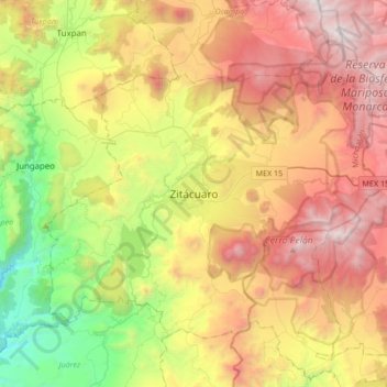
Название: Топографическая карта Zitácuaro, высота, рельеф.
Местонахождение: Zitácuaro, Michoacán, 61506, Mexico (19.27440 -100.51531 19.59440 -100.19531)
Средняя высота: 2 157 м
Минимальная высота: 905 м
Максимальная высота: 3 624 м
Сделать пожертвование