

Сделать пожертвование
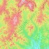
Топографическая карта Câmpina
Нажмите на карту, чтобы отобразить высоту.
Сделать пожертвование
Об этой карте

Название: Топографическая карта Câmpina, высота, рельеф.
Местонахождение: Câmpina, Prahova, Romania (45.10472 25.71337 45.16372 25.76682)
Средняя высота: 463 м
Минимальная высота: 364 м
Максимальная высота: 635 м
Сделать пожертвование
Другие топографические карты
Нажмите на карту, чтобы просмотреть ее топографию, ее высоту и ее рельеф.
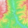
Sinaia
Sinaia is about 65 kilometres (40 miles) northwest of Ploiești and 48 kilometres (30 miles) south of Brașov, in a mountainous area on the Prahova River valley, just east of the Bucegi Mountains. The town's altitude varies between 767 to 860 metres (2,516 to 2,822 feet) above sea level.
Средняя высота: 1 249 м


Comarnic
The town is situated in the southern foothills of the Carpathian Mountains, close to the interface between the Southern Carpathians and the Eastern Carpathians, at an altitude of 555 m (1,821 ft). It lies towards the southern end of the Prahova Valley, along the Prahova River, in the main on the left bank, but…
Средняя высота: 885 м

Сделать пожертвование
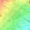
Ploiești
The city lies on the Wallachian Plain, having an average altitude of 150 m (490 ft). The surrounding landscape is influenced by its position around the Prahova River, whose stream bed lies 25 km (16 mi) to the west. The Teleajen River passes through the city while the Dâmbu River passes through the…
Средняя высота: 158 м
Ploiești
The city lies on the Wallachian Plain, having an average altitude of 150 m (490 ft). The surrounding landscape is influenced by its position around the Prahova River, whose stream bed lies 25 km (16 mi) to the west. The Teleajen River passes through the city while the Dâmbu River passes through the…
Средняя высота: 158 м


Сделать пожертвование
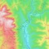
Bușteni
Bușteni (Romanian pronunciation: [buʃˈtenʲ]) is a small mountain town in the north of Prahova County, Muntenia, Romania. It is located in the Prahova Valley, at the bottom of the Bucegi Mountains, that have a maximum altitude of 2,505 m (8,219 ft). Its name literally means tree-logs in Romanian. One…
Средняя высота: 1 419 м
Ploiești
The city lies on the Wallachian Plain, having an average altitude of 150 m (490 ft). The surrounding landscape is influenced by its position around the Prahova River, whose stream bed lies 25 km (16 mi) to the west. The Teleajen River passes through the city while the Dâmbu River passes through the…
Средняя высота: 158 м


Сделать пожертвование


Сделать пожертвование


Сделать пожертвование


Сделать пожертвование


Сделать пожертвование


Сделать пожертвование


Сделать пожертвование


Сделать пожертвование


Sinaia
Sinaia is about 65 kilometres (40 miles) northwest of Ploiești and 48 kilometres (30 miles) south of Brașov, in a mountainous area on the Prahova River valley, just east of the Bucegi Mountains. The town's altitude varies between 767 to 860 metres (2,516 to 2,822 feet) above sea level.
Средняя высота: 1 249 м
Сделать пожертвование


Сделать пожертвование

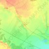
Ploiești
The city lies on the Wallachian Plain, having an average altitude of 150 m (490 ft). The surrounding landscape is influenced by its position around the Prahova River, whose stream bed lies 25 km (16 mi) to the west. The Teleajen River passes through the city while the Dâmbu River passes through the…
Средняя высота: 158 м

Сделать пожертвование
