

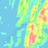
Топографическая карта Yell
Нажмите на карту, чтобы отобразить высоту.
Yell
Yell is 19 miles (31 kilometres) in length, with a maximum breadth of 7.5 miles (12.1 kilometres), and is swept all around by very impetuous tides. The island extends northward to within 9.5 miles (15.3 kilometres) of the northwestern extremity of Unst. It is divided by only the narrow Bluemull Sound from the south west of Unst. On the eastern side the coast is generally low and sandy but there is an extensive rocky and partly precipitous coast on the west that rises slowly to elevations of 200–400 ft (61–122 m). It is indented by seven or eight bays forming natural harbours. As Penrith's guide to Orkney and Shetland states.
Об этой карте

Название: Топографическая карта Yell, высота, рельеф.
Местонахождение: Yell, Shetland, Scotland, United Kingdom (60.48296 -1.20317 60.73315 -0.98149)
Средняя высота: 27 м
Минимальная высота: -7 м
Максимальная высота: 322 м
Другие топографические карты
Нажмите на карту, чтобы просмотреть ее топографию, ее высоту и ее рельеф.





Ronas Hill
United Kingdom > Scotland > Shetland
Ronas Hill (or Rönies Hill) is a hill in Shetland, Scotland. It is classed as a Marilyn, and is the highest point in the Shetland Islands at an elevation of 450 m (1,480 ft). A Neolithic chambered cairn is located near the summit.
Средняя высота: 298 м


