
Сделать пожертвование
Топографическая карта Ravangla
Нажмите на карту, чтобы отобразить высоту.
Сделать пожертвование
Ravangla
Rabong or Ravangla is a small town with an elevation of 8000 feet located, near Namchi City in the Namchi district of the Indian state of Sikkim. It is connected by state highway to other major towns in the state and lies between Namchi, Pelling and Gangtok. It is the starting point for the trek to Maenam Wildlife Sanctuary. It is approximately 65 km from the state capital, Gangtok, and 120 km from Siliguri, West Bengal. The name is derived from the Sikkimese language. ‘Ra’ means wild sheep, 'vong' translates to a rearing place, and ‘la’ means a pass.
Сделать пожертвование
Об этой карте
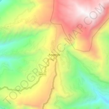
Название: Топографическая карта Ravangla, высота, рельеф.
Местонахождение: Ravangla, Ravong, Namchi, Sikkim, 737139, India (27.26513 88.32447 27.34513 88.40447)
Средняя высота: 1 870 м
Минимальная высота: 682 м
Максимальная высота: 3 229 м
Сделать пожертвование
Другие топографические карты
Нажмите на карту, чтобы просмотреть ее топографию, ее высоту и ее рельеф.