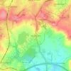
Топографическая карта Clent
Нажмите на карту, чтобы отобразить высоту.
Clent
Because of the hilly topography of the parish the village consists of several distinct hamlets. These are Upper Clent (Clatterbach and the area around the parish church of St. Leonard), Lower Clent, Holy Cross, Adams Hill and Walton Pool. The Civil Parish of Clent also included part of the village of West Hagley, the population of which is about half that of the whole parish. On the first of April 2016, this part of the parish was transferred to the Parish of Hagley. Though in the ancient ecclesiastical parish of Clent, that area is now part of the Anglican parish of Broome. Part of the parish is an area of agricultural lowland, but to the northwest the ground rises forming the Clent Hills (now owned by the National Trust), which is a popular destination for walkers.
Об этой карте

Название: Топографическая карта Clent, высота, рельеф.
Местонахождение: Clent, Bromsgrove, Worcestershire, England, United Kingdom (52.39945 -2.13824 52.43095 -2.07696)
Средняя высота: 184 м
Минимальная высота: 111 м
Максимальная высота: 312 м
Другие топографические карты
Нажмите на карту, чтобы просмотреть ее топографию, ее высоту и ее рельеф.



Tanner's Green
United Kingdom > England > Worcestershire > Bromsgrove > Wythall CP
Средняя высота: 158 м
Beacon Wood
United Kingdom > England > Worcestershire > Bromsgrove > Lydiate Ash
Средняя высота: 210 м
Major's Green
United Kingdom > England > Worcestershire > Bromsgrove > Wythall CP
Средняя высота: 146 м