
Топографическая карта Springfield
Интерактивная карта
Нажмите на карту, чтобы отобразить высоту.
Об этой карте
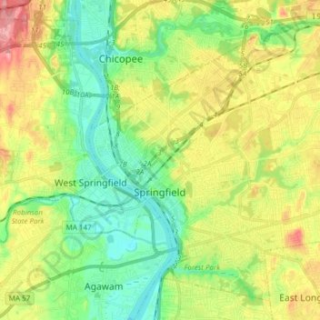
Название: Топографическая карта Springfield, высота, рельеф.
Местонахождение: Springfield, Hampden County, Massachusetts, United States (42.06374 -72.62216 42.16222 -72.47109)
Средняя высота: 50 м
Минимальная высота: 8 м
Максимальная высота: 115 м
Aside from its rivers, Springfield's second most prominent topographical feature is the city's 735-acre (297 ha) Forest Park. Forest Park lies in the southwestern corner of the city, surrounded by Springfield's attractive garden districts, Forest Park and Forest Park Heights, which feature over 600 Victorian Painted Lady mansions. Forest Park also borders Western Massachusetts' most affluent town, Longmeadow. Springfield shares borders with other well-heeled suburbs such as East Longmeadow, Wilbraham, Ludlow and the de-industrializing city of Chicopee. The small cities of Agawam and West Springfield lie less than a mile (1.6 km) from Springfield's Metro Center, across the Connecticut River.