
Топографическая карта Swords
Интерактивная карта
Нажмите на карту, чтобы отобразить высоту.
Об этой карте
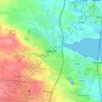
Название: Топографическая карта Swords, высота, рельеф.
Местонахождение: Swords, Fingal, County Dublin, Leinster, K67 X8Y2, Ireland (53.41983 -6.25846 53.49983 -6.17846)
Средняя высота: 28 м
Минимальная высота: -19 м
Максимальная высота: 80 м
At the northern end of the street stands Swords Castle, 200m northeast of the ecclesiastical site, which was built in the early 13th century. A short distance north of the Castle is the elevation known as Spittal Hill, where a hospital once stood.