

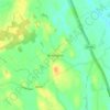
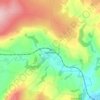
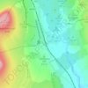
Топографическая карта Malton
Нажмите на карту, чтобы отобразить высоту.
Malton
As with the rest of the British Isles and Yorkshire, Malton possesses a maritime climate with cool summers and mild winters. The nearest Met Office weather station for which records are available is High Mowthorpe, about 6 miles (10 km) east of the town centre. Due to its lower elevation, the town centre is likely to be marginally warmer than High Mowthorpe throughout the year.
Об этой карте

Название: Топографическая карта Malton, высота, рельеф.
Местонахождение: Malton, North Yorkshire, York and North Yorkshire, England, United Kingdom (54.12565 -0.82388 54.17406 -0.73200)
Средняя высота: 28 м
Минимальная высота: 15 м
Максимальная высота: 91 м
Другие топографические карты
Нажмите на карту, чтобы просмотреть ее топографию, ее высоту и ее рельеф.




Scarborough
United Kingdom > England > North Yorkshire
The climate is temperate with mild summers and cool, windy, winters. The hottest months of the year are July and August, with temperatures reaching an average high of 17 °C and falling to 11 °C at night. The average daytime temperatures in January are 4 °C, falling to 1 °C at night. The station's elevation…
Средняя высота: 39 м















Bolton Castle
United Kingdom > England > North Yorkshire > Redmire > Castle Bolton
Средняя высота: 250 м


Thimbleby & Osmotherly Show field
United Kingdom > England > North Yorkshire > Thimbleby
Средняя высота: 152 м











Willerby Brow Plantation
United Kingdom > England > North Yorkshire > Ryedale > Staxton > Binnington
Средняя высота: 100 м


Howgill
United Kingdom > England > North Yorkshire > Craven > Appletreewick > Howgill
Средняя высота: 257 м