
Спасибо за поддержку этого сайта ❤️
Сделать пожертвование
Сделать пожертвование
Топографическая карта Naraingarh
Нажмите на карту, чтобы отобразить высоту.
Спасибо за поддержку этого сайта ❤️
Сделать пожертвование
Сделать пожертвование
Naraingarh
Naraingarh is located near the foothills of the Sivalik range of the Himalayas in northwest India. It covers an area of approximately 481 km2. It shares its borders with the states of Himachal Pradesh. The exact cartographic co-ordinates of Narayangarh are 30°28′N 77°08′E / 30.47°N 77.13°E / 30.47; 77.13.It has an average elevation of 325 metres (1065 ft).
Спасибо за поддержку этого сайта ❤️
Сделать пожертвование
Сделать пожертвование
Об этой карте
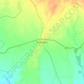
Название: Топографическая карта Naraingarh, высота, рельеф.
Местонахождение: Naraingarh, Ambala, Haryana, 134203, India (30.43239 77.08427 30.51239 77.16427)
Средняя высота: 321 м
Минимальная высота: 305 м
Максимальная высота: 342 м
Спасибо за поддержку этого сайта ❤️
Сделать пожертвование
Сделать пожертвование