
Топографическая карта Statesboro
Интерактивная карта
Нажмите на карту, чтобы отобразить высоту.
Statesboro
According to the United States Census Bureau, the city has a total area of 13.9 square miles (35.9 km2), of which 13.5 square miles (35.0 km2) is land and 0.35 square miles (0.9 km2), or 2.60%, is water. The city is in the coastal plain region, or Low Country, of Georgia, so it is mainly flat with a few small hills. With an elevation of 250 feet (76 m), the downtown area is one of the highest places in Bulloch County. Pine, oak, magnolia, dogwood, palm, sweetgum, and a variety of other trees can be found in the area.
Об этой карте
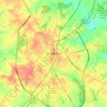
Название: Топографическая карта Statesboro, высота, рельеф.
Местонахождение: Statesboro, Bulloch County, Georgia, 30459, United States of America (32.40901 -81.82329 32.48901 -81.74329)
Средняя высота: 66 м
Минимальная высота: 37 м
Максимальная высота: 86 м