
Топографическая карта Belton
Интерактивная карта
Нажмите на карту, чтобы отобразить высоту.
Belton
Belton is located 60 miles (97 km) north of Austin, 137 miles (220 km) south of Dallas, and 184 miles (296 km) west of Houston. It is near the center of Bell County at 31°3′32″N 97°27′48″W / 31.05889°N 97.46333°W / 31.05889; -97.46333 (31.058904, -97.463382). It is at the point where the Blackland Prairie, characterized by level ground and deep fertile soil, and the Edwards Plateau, characterized by its many springs, hills, and steep canyons, meet. Its elevation is approximately 509 feet (155 m).
Об этой карте
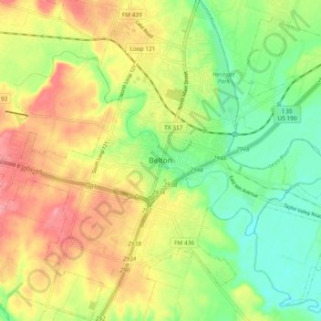
Название: Топографическая карта Belton, высота, рельеф.
Местонахождение: Belton, Bell County, Texas, 76513, United States (31.01601 -97.50445 31.09601 -97.42445)
Средняя высота: 176 м
Минимальная высота: 134 м
Максимальная высота: 223 м