
Сделать пожертвование
Топографическая карта Laleham
Нажмите на карту, чтобы отобразить высоту.
Сделать пожертвование
Об этой карте
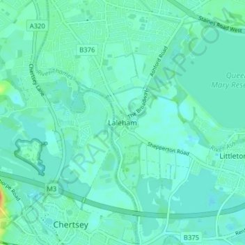
Название: Топографическая карта Laleham, высота, рельеф.
Местонахождение: Laleham, Borough of Spelthorne, Surrey, England, TW18 1SD, United Kingdom (51.38890 -0.51027 51.42890 -0.47027)
Средняя высота: 14 м
Минимальная высота: 7 м
Максимальная высота: 44 м
Сделать пожертвование
Другие топографические карты
Нажмите на карту, чтобы просмотреть ее топографию, ее высоту и ее рельеф.
Queen Mary Reservoir
United Kingdom > England > Surrey > Borough of Spelthorne > Charlton
Средняя высота: 14 м
Сделать пожертвование
Shepperton
United Kingdom > England > Surrey > Borough of Spelthorne
Shepperton has a long boundary with the River Thames in its southernmost salient, which almost surrounds Spelthorne. Old Shepperton is almost surrounded by the extreme southern meander within this. Prehistoric glacial retreat north of this has made the north bank almost flat for a considerable distance and as…
Средняя высота: 12 м