
Топографическая карта Marshall
Интерактивная карта
Нажмите на карту, чтобы отобразить высоту.
Marshall
Marshall is at latitude 44.47N and longitude -95.78W, with an elevation of 354 meters (1,161 feet) above sea level. The city is 150 km (93 mi) northeast of Sioux Falls, South Dakota and 238 km (148 mi) southwest of Minneapolis. It is in the Central Standard time zone and has been assigned the ZIP code of 56258. According to the United States Census Bureau, the city has a total area of 10.08 square miles (26.11 km2), of which 10.07 square miles (26.08 km2) is land and 0.01 square miles (0.03 km2) is water. It is located in a predominantly rural and agricultural area that was originally an expanse of northern tallgrass prairie. The flood plain of the Redwood River begins in Marshall.
Об этой карте
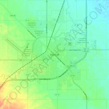
Название: Топографическая карта Marshall, высота, рельеф.
Местонахождение: Marshall, Lyon County, Minnesota, 56258, United States of America (44.40696 -95.82866 44.48696 -95.74866)
Средняя высота: 354 м
Минимальная высота: 340 м
Максимальная высота: 383 м