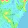
Топографическая карта Woronora
Нажмите на карту, чтобы отобразить высоту.
Woronora
Woronora Plateau, is a geographical region adjacent to the Sydney Plain. Slightly higher in altitude, it is capped with Hawkesbury Sandstone. The Woronora River flows through the deeply dissected plateau to the Georges River from near the sources of the Port Hacking, within the Sutherland Shire.
Об этой карте

Название: Топографическая карта Woronora, высота, рельеф.
Местонахождение: Woronora, Sydney, Sutherland Shire Council, New South Wales, 2232, Australia (-34.03416 151.02830 -34.01351 151.05510)
Средняя высота: 65 м
Минимальная высота: -3 м
Максимальная высота: 118 м
Другие топографические карты
Нажмите на карту, чтобы просмотреть ее топографию, ее высоту и ее рельеф.
























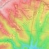






Bents Basin State Conservation Area
Australia > New South Wales > Sydney
The park is popular for swimming, kayaking, bushwalking, camping (with 100 tent sites), barbecuing, picnicking and fishing. The park also features walking trails within a bushland and an education centre with a commercial kitchen. Caley's Lookout Track, a walking track within the bushland, leads to Little…
Средняя высота: 82 м