

Топографическая карта Farnborough
Нажмите на карту, чтобы отобразить высоту.
Farnborough
Farnborough is located in the northeastern corner of the county of Hampshire, near the border with Surrey. The town occupies a valley setting, with the main urban area situated between the River Blackwater to the east and higher ground to the west. The topography gradually rises from the valley floor, reaching a maximum elevation of around 90 metres (300 feet) above sea level on the fringes of the town.
Об этой карте
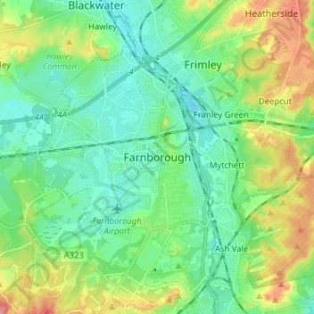
Название: Топографическая карта Farnborough, высота, рельеф.
Местонахождение: Farnborough, Rushmoor, Hampshire, England, GU14 7JT, United Kingdom (51.25187 -0.79398 51.33187 -0.71398)
Средняя высота: 82 м
Минимальная высота: 57 м
Максимальная высота: 137 м