
Топографическая карта Poughkeepsie
Интерактивная карта
Нажмите на карту, чтобы отобразить высоту.
Об этой карте
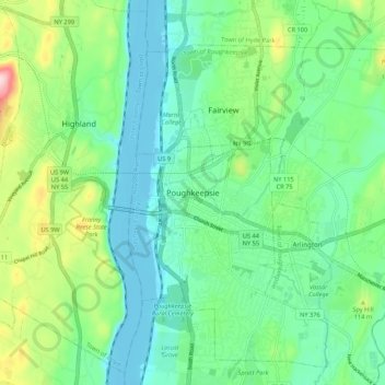
Название: Топографическая карта Poughkeepsie, высота, рельеф.
Местонахождение: Poughkeepsie, Dutchess, New York, 12601, United States of America (41.66658 -73.96841 41.74658 -73.88841)
Средняя высота: 65 м
Минимальная высота: -8 м
Максимальная высота: 241 м
According to the United States Census Bureau, the city has an area of 5.7 square miles (14.8 km2), of which 5.1 square miles (13.3 km2) is land, and 0.23 square miles (0.6 km2) (10.05%) is water. Poughkeepsie lies approximately 75 miles (121 km) north of the center of the New York megacity. It is 73.5 miles (118.28 km) south of the New York state capital of Albany. The highest elevation of Poughkeepsie is 380 feet above sea level on College Hill. Its lowest is on the Hudson River.