
Сделать пожертвование
Топографическая карта Avant
Нажмите на карту, чтобы отобразить высоту.
Сделать пожертвование
Об этой карте
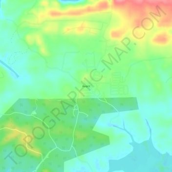
Название: Топографическая карта Avant, высота, рельеф.
Местонахождение: Avant, Garland County, Arkansas, United States (34.62593 -93.35991 34.66593 -93.31991)
Средняя высота: 201 м
Минимальная высота: 171 м
Максимальная высота: 259 м
Сделать пожертвование
Другие топографические карты
Нажмите на карту, чтобы просмотреть ее топографию, ее высоту и ее рельеф.
Hot Springs National Park
United States > Arkansas > Garland County > Hot Springs
The National Park Service exercises no control or supervision over any matters connected with the city. The city starts on the other side of Central Avenue from Bathhouse Row. Its development has extended beyond the narrow valley in which the springs are located, spreading out over the open plain to the south…
Средняя высота: 214 м
Сделать пожертвование
Сделать пожертвование
Hot Springs Village
United States > Arkansas > Garland County > Hot Springs Village
Средняя высота: 226 м
Сделать пожертвование