

Топографическая карта Callanish
Нажмите на карту, чтобы отобразить высоту.
Об этой карте

Название: Топографическая карта Callanish, высота, рельеф.
Местонахождение: Callanish, Western Isles, Scotland, HS2 9DY, United Kingdom (58.17974 -6.75968 58.21974 -6.71968)
Средняя высота: 19 м
Минимальная высота: -2 м
Максимальная высота: 95 м
Другие топографические карты
Нажмите на карту, чтобы просмотреть ее топографию, ее высоту и ее рельеф.
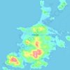
South Uist
United Kingdom > Scotland > Western Isles
In the north west of the island at (57°20′N 07°20′W / 57.333°N 7.333°W / 57.333; -7.333), a missile testing range was built in 1957–58 to launch the Corporal missile, Britain and America's first guided nuclear weapon. This development went ahead despite significant protests, some locals…
Средняя высота: 15 м
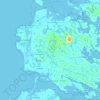
Barra
United Kingdom > Scotland > Western Isles > Brevig
The highest elevation on the island is Heaval, near the top of which is a prominent white marble statue of the Madonna and Child, called "Our Lady of the Sea", which was erected during the Marian year of 1954. The predominant faith on the island is Catholicism and the Catholic church dedicated to Our Lady of…
Средняя высота: 27 м
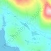
Benbecula
United Kingdom > Scotland > Western Isles > Nunton
There is a dense cluster of lochs across almost the entire island, and almost the whole island is below 20 metres (70 feet) in elevation.
Средняя высота: 5 м
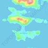
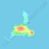
North Rona
United Kingdom > Scotland > Western Isles
Rona (Scottish Gaelic: Rònaigh) is an uninhabited Scottish island in the North Atlantic. It is often referred to as North Rona to distinguish it from the island of South Rona in the Inner Hebrides. It has an area of 109 hectares (270 acres) and a maximum elevation of 108 metres (354 ft).
Средняя высота: 4 м


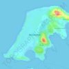


Barra
United Kingdom > Scotland > Western Isles > Borve
The highest elevation on the island is Heaval, near the top of which is a prominent white marble statue of the Madonna and Child, called "Our Lady of the Sea", which was erected during the Marian year of 1954. The predominant faith on the island is Catholicism and the Catholic church dedicated to Our Lady of…
Средняя высота: 27 м
Barra
United Kingdom > Scotland > Western Isles > Borve
The highest elevation on the island is Heaval, near the top of which is a prominent white marble statue of the Madonna and Child, called "Our Lady of the Sea", which was erected during the Marian year of 1954. The predominant faith on the island is Catholicism and the Catholic church dedicated to Our Lady of…
Средняя высота: 27 м
Benbecula
United Kingdom > Scotland > Western Isles > Nunton
There is a dense cluster of lochs across almost the entire island, and almost the whole island is below 20 metres (70 feet) in elevation.
Средняя высота: 5 м

Benbecula
United Kingdom > Scotland > Western Isles > Torlum
There is a dense cluster of lochs across almost the entire island, and almost the whole island is below 20 metres (70 feet) in elevation.
Средняя высота: 5 м

