Топографическая карта Roccasecca
Нажмите на карту, чтобы отобразить высоту.
Roccasecca
The history of Roccasecca is tightly bound to its strategic position, a "dry rocca" at the entrance to two narrow defiles that give access to the Valle di Comino below the slopes of Monte Asprano, whose elevation at 553 metres (1,814 ft) provides a natural position to control the wide Valle del Liri. Remains of archaic perimeter walling attest to an early fortified presence around the site. Roccasecca served as a way station for ancient Roman legions and invading armies crossing the River Melfa, spanned by three ancient bridges there, remains of which still exist. However, the Medieval commune truly began in the early Middle Ages.
Об этой карте
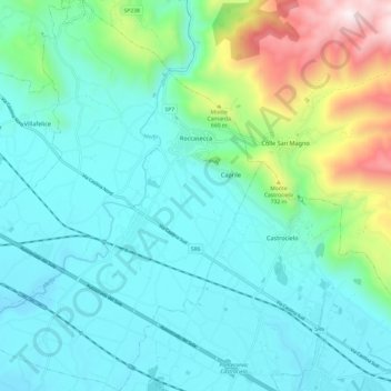
Название: Топографическая карта Roccasecca, высота, рельеф.
Местонахождение: Roccasecca, Frosinone, Lazio, 03038, Italy (41.49380 13.58465 41.58416 13.68777)
Средняя высота: 327 м
Минимальная высота: 72 м
Максимальная высота: 1 306 м
Другие топографические карты
Нажмите на карту, чтобы просмотреть ее топографию, ее высоту и ее рельеф.