
Топографическая карта Volcano
Интерактивная карта
Нажмите на карту, чтобы отобразить высоту.
Volcano
Its altitude ranges from below 2,800 feet (850 m) in the southeast to over 6,200 feet (1,900 m) at its uninhabited northern end. Due to this, Volcano features a subtropical highland climate (Köppen Cfb), with relatively uniform temperatures and abundant rainfall throughout the year, although rainfall is concentrated during the months of November through April.
Об этой карте
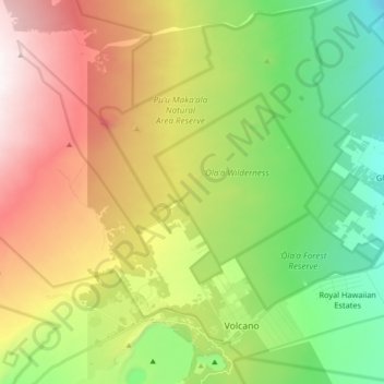
Название: Топографическая карта Volcano, высота, рельеф.
Местонахождение: Volcano, Hawaiʻi County, Hawaii, United States (19.41769 -155.34518 19.56076 -155.16399)
Средняя высота: 1 219 м
Минимальная высота: 715 м
Максимальная высота: 1 959 м