
Топографическая карта Grasmere
Интерактивная карта
Нажмите на карту, чтобы отобразить высоту.
Об этой карте
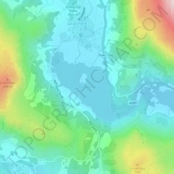
Название: Топографическая карта Grasmere, высота, рельеф.
Местонахождение: Grasmere, Lakes, Grasmere, South Lakeland, Cumbria, North West England, England, United Kingdom (54.44391 -3.03094 54.45507 -3.01396)
Средняя высота: 162 м
Минимальная высота: 54 м
Максимальная высота: 501 м
The lake is 1680 yd (1540 m) long and 700 yd (640 m) wide, covering an area of 0.24 mi² (0.62 km²). It has a maximum depth of 70 ft (21m) and an elevation above sea level of 208 ft (62 m). The lake is both fed and drained by the River Rothay, which flows through the village before entering the lake, and then exits downstream into nearby Rydal Water, beyond which it continues into Windermere.