
Топографическая карта Cauvery
Интерактивная карта
Нажмите на карту, чтобы отобразить высоту.
Об этой карте
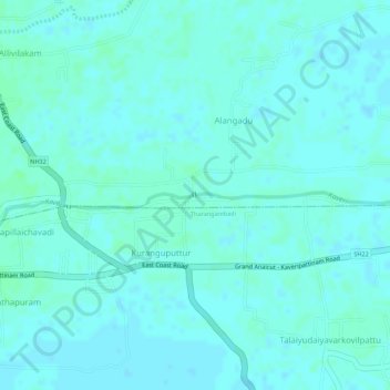
Название: Топографическая карта Cauvery, высота, рельеф.
Местонахождение: Cauvery, Alangadu, Sirkali, Mayiladuthurai District, Tamil Nadu, 609109, India (11.14956 79.78138 11.14959 79.78151)
Средняя высота: 7 м
Минимальная высота: 4 м
Максимальная высота: 10 м
The Kaveri (also known as Cauvery, the anglicised name) is one of the major Indian rivers flowing through the states of Karnataka and Tamil Nadu. The Kaveri River rises at Talakaveri in the Brahmagiri range in the Western Ghats, Kodagu district of the state of Karnataka, at an elevation of 1,341 m above mean sea level and flows for about 800 km before its outfall into the Bay of Bengal. It reaches the sea in Poompuhar, in Mayiladuthurai district. It is the third largest river – after Godavari and Krishna – in southern India, and the largest in the state of Tamil Nadu, which, on its course, bisects the state into north and south. In ancient Tamil literature, the river was also called Ponni (the golden mother, in reference to the fine silt it deposits).