
Топографическая карта Albany
Интерактивная карта
Нажмите на карту, чтобы отобразить высоту.
Albany
According to the United States Census Bureau, the city has a total area of 17.75 square miles (45.97 km2), of which 17.54 square miles (45.43 km2) is land and 0.21 square miles (0.54 km2) is water. Albany has 21.7 square miles (56 km2) within its urban growth boundary. Throughout the city limits and urban growth area, there are limited hills; the city is one of the lowest points along the Willamette Valley, with elevations ranging 180 to 430 feet (55 to 131 m) above sea level. The North Albany District has the most variable elevation, while the downtown and southern end of town have little elevation change throughout.
Об этой карте
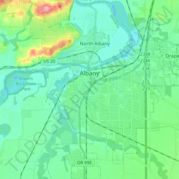
Название: Топографическая карта Albany, высота, рельеф.
Местонахождение: Albany, Linn County, Oregon, United States (44.57758 -123.14740 44.67675 -123.03266)
Средняя высота: 71 м
Минимальная высота: 48 м
Максимальная высота: 158 м
Другие топографические карты
Нажмите на карту, чтобы просмотреть ее топографию, ее высоту и ее рельеф.