
Топографическая карта East Greenbush
Интерактивная карта
Нажмите на карту, чтобы отобразить высоту.
Об этой карте
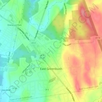
Название: Топографическая карта East Greenbush, высота, рельеф.
Местонахождение: East Greenbush, Town of East Greenbush, Rensselaer County, New York, United States (42.58028 -73.72045 42.61268 -73.68254)
Средняя высота: 97 м
Минимальная высота: 57 м
Максимальная высота: 148 м
The western section of the town along the Hudson River is marked by bluffs that rise to an elevation of between 100 and 300 feet. The little flat land that exists along the river is on the Papscanee Island. Papscanee Island is actually a peninsula, separated from the rest of the town by the Papscanee Creek. The town then spreads out as rolling hills rising towards the east. Mill Creek (formerly Tierken Kill) and Morden Creek are the principal streams of the town.