
Топографическая карта Stanthorpe
Интерактивная карта
Нажмите на карту, чтобы отобразить высоту.
Stanthorpe
Owing to its elevation, Stanthorpe features a subtropical highland climate. At an altitude of 811 metres (2,661 ft), Stanthorpe holds the record for the lowest temperature recorded in Queensland at −10.6 °C (12.9 °F) on 23 June 1961. Sleet and light snowfalls are occasionally recorded, with the most significant snowfall in over 30 years occurring on 17 July 2015.
Об этой карте
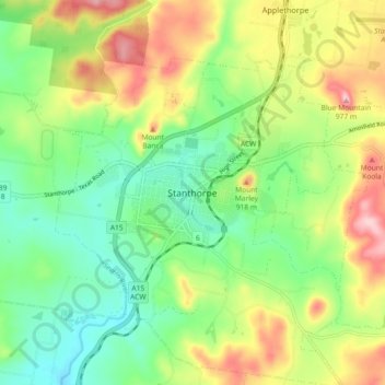
Название: Топографическая карта Stanthorpe, высота, рельеф.
Местонахождение: Stanthorpe, Southern Downs Regional, Queensland, 4380, Australia (-28.69599 151.89383 -28.61599 151.97383)
Средняя высота: 840 м
Минимальная высота: 760 м
Максимальная высота: 966 м