
Спасибо за поддержку этого сайта ❤️
Сделать пожертвование
Сделать пожертвование
Топографическая карта Mérida
Нажмите на карту, чтобы отобразить высоту.
Спасибо за поддержку этого сайта ❤️
Сделать пожертвование
Сделать пожертвование
Mérida
The city is located near the center of the Chicxulub Crater. It has a very flat topography and is only 9 metres (30 ft) above sea level. The land outside of Mérida is covered with smaller scrub trees and former henequen fields. Almost no surface water exists, but several cenotes (sinkholes that provide access to underground springs and rivers) are found in the area.
Спасибо за поддержку этого сайта ❤️
Сделать пожертвование
Сделать пожертвование
Об этой карте
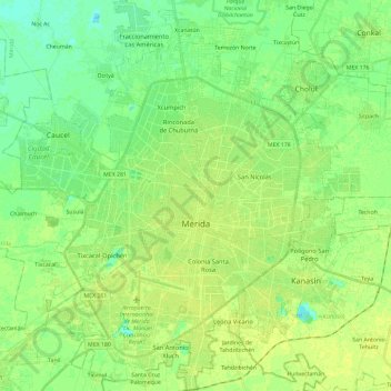
Название: Топографическая карта Mérida, высота, рельеф.
Местонахождение: Mérida, Yucatán, Mexico (20.87331 -89.72620 21.09205 -89.53017)
Средняя высота: 9 м
Минимальная высота: 1 м
Максимальная высота: 15 м
Спасибо за поддержку этого сайта ❤️
Сделать пожертвование
Сделать пожертвование