
Спасибо за поддержку этого сайта ❤️
Сделать пожертвование
Сделать пожертвование
Топографическая карта Hallasan
Нажмите на карту, чтобы отобразить высоту.
Спасибо за поддержку этого сайта ❤️
Сделать пожертвование
Сделать пожертвование
Hallasan
The occurrence of the highest temperature coincides with the formation position of the eddy, and when the wind is weak, the eddy forms in the middle mountain region. When the wind is weak, the warmth is accumulated in the middle layer, so the maximum temperature in the mid-mountainous area is higher than the maximum temperature of the low-altitude coastal area about 1–3 °C, and 4 °C or higher on the downwind side.
Спасибо за поддержку этого сайта ❤️
Сделать пожертвование
Сделать пожертвование
Об этой карте
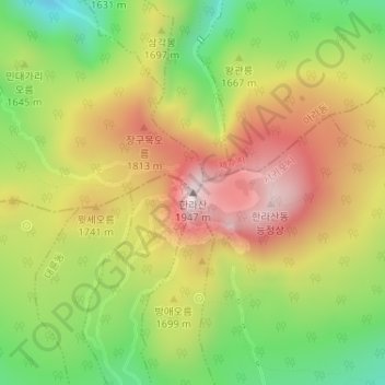
Название: Топографическая карта Hallasan, высота, рельеф.
Местонахождение: Hallasan, Jeju, South Korea (33.36170 126.52915 33.36180 126.52925)
Средняя высота: 1 652 м
Минимальная высота: 1 376 м
Максимальная высота: 1 929 м
Спасибо за поддержку этого сайта ❤️
Сделать пожертвование
Сделать пожертвование