

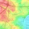
Топографическая карта Ackworth
Нажмите на карту, чтобы отобразить высоту.
Ackworth
Quarrying was also important around the areas of Moor Top and Brackenhill. There was a long tradition of quarrying and masonry, and the production of building stone and high-quality grindstones used in agriculture and tool-making. Saywell (1894) describes Brackenhill as "almost entirely inhabited by stoneworkers" and Moor Top consisting of "several good houses, the rest are the cottages of miners and quarryworkers". Saywell describes "extensive quarrying" in the south and south-west of the Ackworth area, with stone running "near the surface" in many areas. He calls Ackworth stone "good, but in places... exceptionally soft and unfit for building purposes, which accounts for so many faults". The 1848 Topographical History of Great Britain notes "extensive quarries" of stone found in Moor Top, with an abundant supply of "freestone of excellent quality".
Об этой карте

Название: Топографическая карта Ackworth, высота, рельеф.
Местонахождение: Ackworth, Low Ackworth, Wakefield, West Yorkshire, England, United Kingdom (53.63068 -1.36015 53.67287 -1.28498)
Средняя высота: 45 м
Минимальная высота: 22 м
Максимальная высота: 80 м
Другие топографические карты
Нажмите на карту, чтобы просмотреть ее топографию, ее высоту и ее рельеф.




Featherstone Colliery
United Kingdom > England > Wakefield > Featherstone > Snydale
Средняя высота: 44 м


