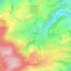
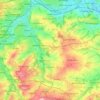
Топографическая карта Slaithwaite
Нажмите на карту, чтобы отобразить высоту.
Slaithwaite
In the 1848 edition of 'A Topographical Dictionary of England', Samuel Lewis (the editor) wrote:- "the lands are in meadow and pasture, with a small portion of arable; the scenery is bold and romantic. In the quarries of the district are found vegetable fossils, especially firs and other mountain trees. The village is beautifully seated in the valley of the river Colne; the inhabitants are chiefly employed in the woollen manufacture, in the spinning of cotton and silk, and in silk-weaving"
Об этой карте

Название: Топографическая карта Slaithwaite, высота, рельеф.
Местонахождение: Slaithwaite, Kirklees, West Yorkshire, England, HD7 5AG, United Kingdom (53.60358 -1.89938 53.64358 -1.85938)
Средняя высота: 241 м
Минимальная высота: 107 м
Максимальная высота: 391 м
Другие топографические карты
Нажмите на карту, чтобы просмотреть ее топографию, ее высоту и ее рельеф.