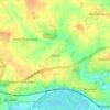
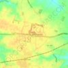
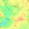
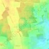
Топографическая карта Heydon
Нажмите на карту, чтобы отобразить высоту.
Heydon
By the village green there is an 18th-century public house – The Earle Arms – which is grade II listed and has a "Regionally Important Historic Interior". It was until circa 1845 called the Lion and Lamb. It is believed that a pub has existed at this location since the 16th century, and was a coaching inn. The front elevation of the building features a wood sculpture of Mary Read, an 18th-century pirate, believed to originate from that century.
Об этой карте

Название: Топографическая карта Heydon, высота, рельеф.
Местонахождение: Heydon, Broadland, Norfolk, England, United Kingdom (52.78334 1.09536 52.82932 1.17642)
Средняя высота: 44 м
Минимальная высота: 20 м
Максимальная высота: 60 м
Другие топографические карты
Нажмите на карту, чтобы просмотреть ее топографию, ее высоту и ее рельеф.

Great Witchingham Village Hall Park
United Kingdom > England > Norfolk > Broadland > Lenwade > Great Witchingham
Средняя высота: 26 м