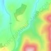
Топографическая карта Tomintoul
Нажмите на карту, чтобы отобразить высоту.
Tomintoul
Tomintoul has an oceanic climate (Cfb), bordering on subpolar oceanic (Cfc). Tomintoul does not have an official MetOffice weather station, and the temperature values below are simulated. Due to the villages' location northeast of the Cairngorms massif, it is exposed to many snow-bearing wind directions; this is consolidated by its elevation of 345m above sea level and its latitude at 57°N. As a result, Tomintoul is one of the coldest and snowiest settlements in the UK.
Об этой карте

Название: Топографическая карта Tomintoul, высота, рельеф.
Местонахождение: Tomintoul, Moray, Scotland, AB37 9ET, United Kingdom (57.23193 -3.39932 57.27193 -3.35932)
Средняя высота: 374 м
Минимальная высота: 274 м
Максимальная высота: 546 м
Другие топографические карты
Нажмите на карту, чтобы просмотреть ее топографию, ее высоту и ее рельеф.
Fochabers
United Kingdom > Scotland > Moray
The present village owes its existence to Alexander Gordon, 4th Duke of Gordon (1743–1827). During the late eighteenth century, during the Scottish Enlightenment, it was fashionable for landowners to found new towns and villages; these can be recognised all over Scotland, because unlike their predecessors…
Средняя высота: 59 м