
Топографическая карта Bolinas
Интерактивная карта
Нажмите на карту, чтобы отобразить высоту.
Bolinas
Bolinas sits at an elevation of 36 feet (11 m) above sea level. It is bound on the northeast by Bolinas Lagoon and Kent Island and on the south by Bolinas Bay and Duxbury Point. According to the United States Census Bureau, the CDP has a total area of 5.8 square miles (15 km2), all of it land. The GNIS has cited archaic alternate town-names, including "Ballenas", "Baulenas", "Baulings", and "Bawlines".
Об этой карте
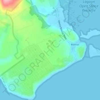
Название: Топографическая карта Bolinas, высота, рельеф.
Местонахождение: Bolinas, Hillside, Bolinas, Marin County, California, 94924, United States of America (37.89391 -122.71636 37.92177 -122.68199)
Средняя высота: 28 м
Минимальная высота: -1 м
Максимальная высота: 149 м