Сделать пожертвование
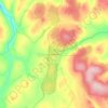
Топографическая карта Enontekiö
Нажмите на карту, чтобы отобразить высоту.
Сделать пожертвование
Enontekiö
The lower heathlands are dominated by shrubs such as Betula nana, Vaccinium myrtillus and Empetrum hermaphroditum, whereas in the fjell heaths at higher elevations Salix herbacea, Empetrum and alpine grasses with lichens and mosses occur. In the mountains of the north-west Cassiope tetragona is abundant. The largest part of the municipal area consists of these plateaus or bogs, which mainly predominate at the rivers. Only 19% of Enontekiö's area is afforested. About 70% of the total area is conservation area of various grades. Enontekiö contains parts of the Pallas-Yllästunturi National Park, as well as the wilderness areas of Käsivarsi, Pulju, Pöyrisjärvi and Tarvantovaara.
Сделать пожертвование
Об этой карте

Название: Топографическая карта Enontekiö, высота, рельеф.
Местонахождение: Enontekiö, Fell Lapland sub-region, Lapland, Mainland Finland, Finland (68.11596 20.54864 69.31188 25.02724)
Средняя высота: 405 м
Минимальная высота: 91 м
Максимальная высота: 1 070 м
Сделать пожертвование
Другие топографические карты
Нажмите на карту, чтобы просмотреть ее топографию, ее высоту и ее рельеф.


Kilpisjärvi
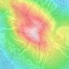
Although Kilpisjärvi is one of the largest villages in Enontekiö, it is still quite small. In 2000 its population was recorded as 114. Like most Sami villages, Kilpisjärvi is built mainly around one major road, Käsivarrentie, or the "Arm Road" and Neljäntuulentie, or the "Four Winds' Road" — also known…
Средняя высота: 527 м
Сделать пожертвование


Сделать пожертвование



Сделать пожертвование


Сделать пожертвование


Сделать пожертвование


Сделать пожертвование