
Топографическая карта Suez Canal
Интерактивная карта
Нажмите на карту, чтобы отобразить высоту.
Suez Canal
Despite the construction challenges that could have been the result of the alleged difference in sea levels, the idea of finding a shorter route to the east remained alive. In 1830, General Francis Chesney submitted a report to the British government that stated that there was no difference in elevation and that the Suez Canal was feasible, but his report received no further attention. Lieutenant Waghorn established his "Overland Route", which transported post and passengers to India via Egypt.
Об этой карте
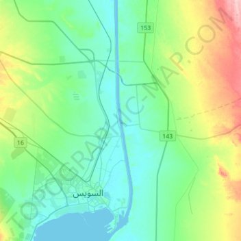
Название: Топографическая карта Suez Canal, высота, рельеф.
Местонахождение: Suez Canal, Suez, Egypt (29.92639 32.55958 30.16442 32.58845)
Средняя высота: 39 м
Минимальная высота: -3 м
Максимальная высота: 161 м
Другие топографические карты
Нажмите на карту, чтобы просмотреть ее топографию, ее высоту и ее рельеф.