
Сделать пожертвование
Топографическая карта Western Ghats
Нажмите на карту, чтобы отобразить высоту.
Сделать пожертвование
Western Ghats
The range starts near south of the Tapti river and runs approximately 1,600 km (990 mi) through the states of Gujarat, Maharashtra, Karnataka, Goa, Kerala and Tamil Nadu ending at Marunthuvazh Malai near the southern tip of India. These hills cover 160,000 km2 (62,000 sq mi) and form the catchment area for complex riverine drainage systems that drain almost 40% of India. The Western Ghats block the southwest monsoon winds from reaching the Deccan Plateau. The average elevation is around 1,200 m (3,900 ft).
Сделать пожертвование
Об этой карте
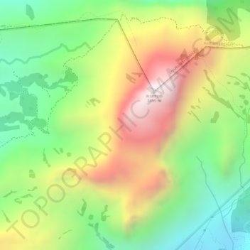
Название: Топографическая карта Western Ghats, высота, рельеф.
Местонахождение: Western Ghats, Devikulam, Idukki, Kerala, 685614, India (10.16595 77.05795 10.16605 77.05805)
Средняя высота: 2 225 м
Минимальная высота: 1 828 м
Максимальная высота: 2 685 м
Сделать пожертвование
Другие топографические карты
Нажмите на карту, чтобы просмотреть ее топографию, ее высоту и ее рельеф.
Сделать пожертвование
Сделать пожертвование