
Топографическая карта Altona
Интерактивная карта
Нажмите на карту, чтобы отобразить высоту.
Altona
The hamlet of Altona is located in the northern part of the town of Altona at 44°53′24″N 73°39′9″W / 44.89000°N 73.65250°W / 44.89000; -73.65250 (44.890096, -73.65272). The Great Chazy River flows along the southeastern edge of the hamlet, dropping 150 feet (46 m) in elevation in 1.7 miles (2.7 km). The Ganienkeh Community of the Mohawk people is southwest of the hamlet.
Об этой карте
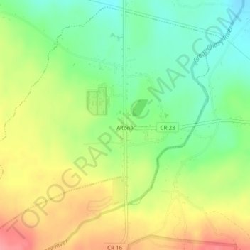
Название: Топографическая карта Altona, высота, рельеф.
Местонахождение: Altona, Town of Altona, Clinton County, New York, United States (44.87602 -73.67907 44.90157 -73.64087)
Средняя высота: 196 м
Минимальная высота: 157 м
Максимальная высота: 243 м