
Сделать пожертвование
Топографическая карта Sacaton
Нажмите на карту, чтобы отобразить высоту.
Сделать пожертвование
Об этой карте
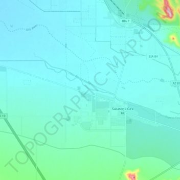
Название: Топографическая карта Sacaton, высота, рельеф.
Местонахождение: Sacaton, Pinal County, Arizona, United States (33.07122 -111.82431 33.10223 -111.72045)
Средняя высота: 400 м
Минимальная высота: 371 м
Максимальная высота: 616 м
Сделать пожертвование
Другие топографические карты
Нажмите на карту, чтобы просмотреть ее топографию, ее высоту и ее рельеф.
Сделать пожертвование
Сделать пожертвование
Kearny
United States > Arizona > Pinal County
Kearny Airport is a general aviation airport located in the southern section of the town. In 2003 it received the Arizona Department of Transportation's Airport of the Year award. The airport has a single asphalt runway, 3,400 feet (1,000 m) in length and 60 feet (18 m) in width, with a field elevation of…
Средняя высота: 578 м
Сделать пожертвование
Сделать пожертвование
Oracle
United States > Arizona > Pinal County
Oracle has a cold semi-arid climate at an altitude of 4,500 feet (1,400 m). The record high temperature for Oracle was 109 °F (43 °C) recorded in July 1995. The record low temperature was 6 °F (−14 °C) recorded in December 1990. In January, the average high temperature is 56.7 °F (14 °C) with a low of…
Средняя высота: 1 380 м
Сделать пожертвование
Superior
United States > Arizona > Pinal County
Superior has a hot semi-arid climate. In January, the average high temperature is 61 °F (16 °C) with a low of 43 °F (6 °C). In July, the average high temperature is 98 °F (37 °C) with a low of 76 °F (24 °C). Annual precipitation is just over 18 inches, but is higher at greater altitudes. Despite its…
Средняя высота: 959 м
Сделать пожертвование
Maricopa
United States > Arizona > Pinal County
The topography in Maricopa is flat, with several mountain ranges 10 to 20 miles away. The elevation of Maricopa is 1190 feet.
Средняя высота: 369 м
Superior
United States > Arizona > Pinal County
Superior has a hot semi-arid climate. In January, the average high temperature is 61 °F (16 °C) with a low of 43 °F (6 °C). In July, the average high temperature is 98 °F (37 °C) with a low of 76 °F (24 °C). Annual precipitation is just over 18 inches, but is higher at greater altitudes. Despite its…
Средняя высота: 959 м
Сделать пожертвование
Oracle
United States > Arizona > Pinal County
At an altitude of 4,500 feet (1,400 m), Oracle has a Mediterranean climate (Köppen Csa), somewhat similar to Prescott further northwestward. Unlike most climates of its type, only the early summer is dry, with monsoonal thunderstorms producing substantial rain in July and August. The winter season from…
Средняя высота: 1 380 м
Сделать пожертвование
Maricopa
United States > Arizona > Pinal County
The topography in Maricopa is flat, with several mountain ranges 10 to 20 miles away. The elevation of Maricopa is 1190 feet.
Средняя высота: 369 м
Heaton
United States > Arizona > Pinal County > Maricopa
Heaton is a populated place situated in Pinal County, Arizona, United States. Originally called Maricopa Station, it served as a stop on the railroad line, where passengers transferred to stagecoach. The post office at this location was simply named Maricopa. During a land boom in the late 1880s, it was…
Средняя высота: 366 м