
Топографическая карта Asia Minor
Интерактивная карта
Нажмите на карту, чтобы отобразить высоту.
Об этой карте
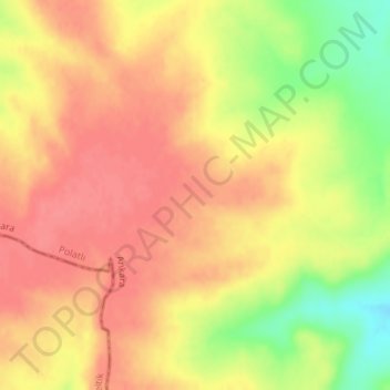
Название: Топографическая карта Asia Minor, высота, рельеф.
Местонахождение: Asia Minor, Полатлы, Анкара, Центральная Анатолия, 06900, Турция (38.99995 31.99995 39.00005 32.00005)
Средняя высота: 952 м
Минимальная высота: 907 м
Максимальная высота: 974 м